
2023-2024 оқу жылына арналған
қысқа мерзімді сабақ жоспарларын
жүктеп алғыңыз келеді ма?
ҚР Білім және Ғылым министірлігінің стандартымен 2022-2023 оқу жылына арналған 472-бұйрыққа сай жасалған

My town’s history
Материал туралы қысқаша түсінік
Бұл материал 5 сыныпқа беретін мұғалімдерге көмегі тиуі мүмкін.
Авторы:
Автор материалды ақылы түрде жариялады.
Сатылымнан түскен қаражат авторға автоматты түрде аударылады. Толығырақ
Сатылымнан түскен қаражат авторға автоматты түрде аударылады. Толығырақ
 17 Мамыр 2021
 223
223 0 рет жүктелген
Бүгін алсаңыз
25% жеңілдік
беріледі
беріледі
770 тг 578 тг

Тегін турнир Мұғалімдер мен Тәрбиешілерге
Дипломдар мен сертификаттарды алып үлгеріңіз!
Дипломдар мен сертификаттарды алып үлгеріңіз!

Бұл бетте материалдың қысқаша нұсқасы ұсынылған. Материалдың толық нұсқасын жүктеп алып, көруге болады
1
2
...
6
Материал жариялап тегін сертификат алыңыз!
Бұл сертификат «Ustaz tilegi» Республикалық ғылыми – әдістемелік журналының желілік басылымына өз авторлық жұмысын жарияланғанын растайды. Журнал Қазақстан Республикасы Ақпарат және Қоғамдық даму министрлігінің №KZ09VPY00029937 куәлігін алған. Сондықтан аттестацияға жарамды
Ресми байқаулар тізімі
Республикалық байқауларға қатысып жарамды дипломдар алып санатыңызды көтеріңіз!
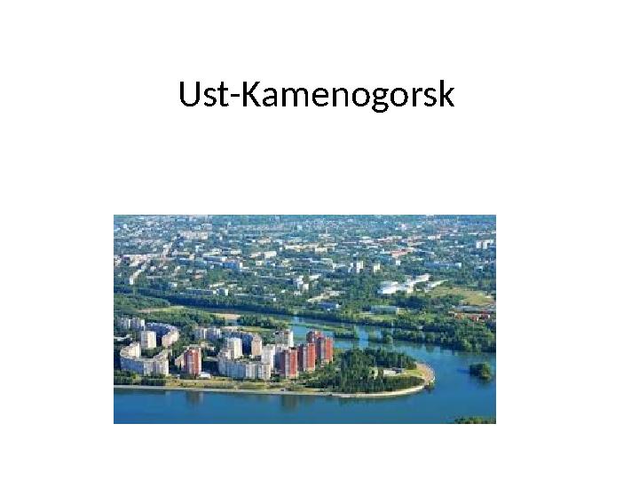
1 слайд
Ust-Kamenogorsk
) Is the largest city in the east of Kazakhstan, the administrative cente")
2 слайд
Ust-Kamenogorsk
•
Ust-Kamenogorsk (Kaz. Skemen (inf.)) Is the
largest city in the east of Kazakhstan, the
administrative center of the East Kazakhstan
region (since 1939).

3 слайд
Ust-Kamenogorsk
•
In the 9th-13th centuries, the Naiman and Kerey tribes
lived on the territory of the Irtysh region. In the 15th
century, during the formation of the Kazakh Khanate,
these tribes entered the Middle Zhuz [6]. In 1720, under
the rule of the Dzungar Khanate, to search for gold in
Yarkand, the Russian Empire founded the Ust-
Kamenogorsk fortress, which in 1868 received the status
of a city [7] [8]. Until 1932, the city was part of the Tomsk
province, Omsk region, Altai province, Semipalatinsk
province, Altai mountain district and Semipalatinsk
district. Ust-Kamenogorsk

4 слайд
Ust-Kamenogorsk
•
Ust-Kamenogorsk is located in the eastern part
of modern Kazakhstan, at the confluence of
the Ulba River with the Irtysh River, about 280
kilometers west of Belukha Mountain, the
highest point of the Altai Mountains and 947
km from the capital Nur-Sultan. This region of
the Altai mountain system is historically called
the Rudny Altai.

5 слайд
Ust-Kamenogorsk
•
At the heart of the coat of arms is a shield of a
classical form, which depicts mountain peaks
with water spaces between them, which
symbolizes the Ulba and Irtysh rivers framed
by green banks. In the upper part of the coat
of arms there is the name of the city, in the
lower part there is a watchtower entwined
with a ribbon on which the year of the
foundation of the fortress appears.

6 слайд
Ust-Kamenogorsk
•
Thanks for attention
Материал іздеу
Сіз үшін 400 000 ұстаздардың еңбегі мен тәжірибесін біріктіріп, ең үлкен материалдар базасын жасадық. Төменде пәніңізді белгілеп, керек материалды алып сабағыңызға қолдана аласыз
Барлығы 663 959 материал жиналған
Ұқсас материалдар
 Дайын ҚМЖ. Барлық пәндерден 2022-2023 оқу жылына, жаңа бұйрыққа сай жасалған 01.01.2023 17 863 13 694
ҚР Білім және Ғылым министірлігінің стандарты бойынша жасалған. 2022-2023 оқу жылына арналған
Барлық пәндер
Барлық материалдар
Барлық сыныптар
Іс-шаралар кестесі
Педагогтардың біліктілігін арттыру курстары