ЖИ көмекші


Лекция по дисциплине ArcGIS
Тақырып бойынша 11 материал табылды
Лекция по дисциплине ArcGIS
Материал туралы қысқаша түсінік
Лекция для магистрантов
Материалдың қысқаша нұсқасы
1 / 40

 Жүктеу
Бөлісу
ЖИ арқылы жасау
Слайдтың жеке беттері
#1 слайд
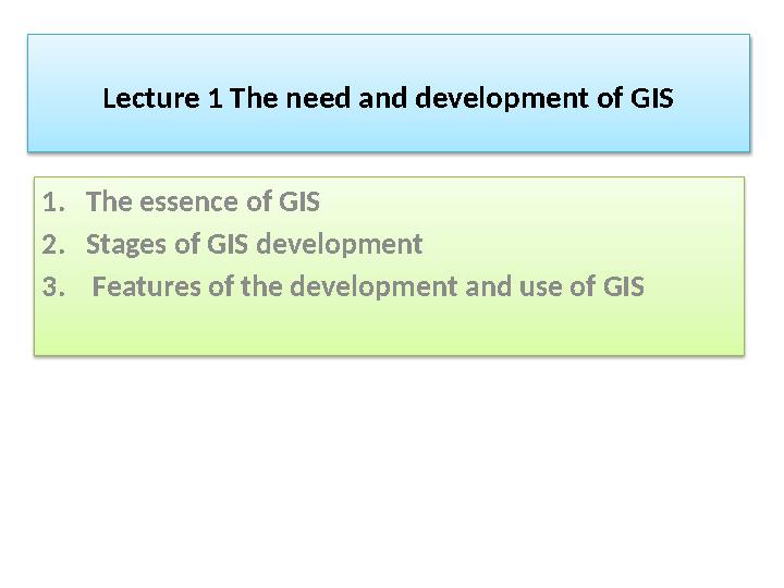
Lecture 1 The need and development of GIS
1. The essence of GIS
2. Stages of GIS development
3. Features of the development and use of GIS
1 слайд
Lecture 1 The need and development of GIS 1. The essence of GIS 2. Stages of GIS development 3. Features of the development and use of GIS
 is a multifunctional information system designed for collecting, processing, modeling an")
#2 слайд
A geographic information system (GIS) is a
multifunctional information system designed for
collecting, processing, modeling and analyzing spatial
data, displaying them and using them in solving
computational problems, preparing and making
decisions .
2 слайд
A geographic information system (GIS) is a multifunctional information system designed for collecting, processing, modeling and analyzing spatial data, displaying them and using them in solving computational problems, preparing and making decisions .

#3 слайд
The main purpose of GIS is to form knowledge
about the Earth, individual territories, and
terrain, as well as timely delivery of necessary
and sufficient spatial data to users in order to
achieve the greatest efficiency of their work.
3 слайд
The main purpose of GIS is to form knowledge about the Earth, individual territories, and terrain, as well as timely delivery of necessary and sufficient spatial data to users in order to achieve the greatest efficiency of their work.

#4 слайд
Pioneer period : late 50s-early 70s of the last century.
During this period, in the field of information
technology, work is being carried out to study new
possibilities of cartography using electronic computer
technology.
4 слайд
Pioneer period : late 50s-early 70s of the last century. During this period, in the field of information technology, work is being carried out to study new possibilities of cartography using electronic computer technology.

#5 слайд
This period is characterized by the development of
cartography in connection with the rapid
development of computer technologies: the
creation and use of electronic computers in the
50s, printers, large graphic displays, surface
analyzers and other peripheral devices
5 слайд
This period is characterized by the development of cartography in connection with the rapid development of computer technologies: the creation and use of electronic computers in the 50s, printers, large graphic displays, surface analyzers and other peripheral devices

#6 слайд
Of particular importance were scientific and
theoretical works in the field of geography and
cartography and on the assessment of spatial
relationships between geo-objects, as well as the
study of quantitative methods in geography in
the United States, Canada, England, Sweden
(works by W. Garrison (William Garrison), T.
Hagerstrand (Torsten Hagerstrand), G. McCarty
(Harold McCarty), J. McHarg (Ian McHarg).
6 слайд
Of particular importance were scientific and theoretical works in the field of geography and cartography and on the assessment of spatial relationships between geo-objects, as well as the study of quantitative methods in geography in the United States, Canada, England, Sweden (works by W. Garrison (William Garrison), T. Hagerstrand (Torsten Hagerstrand), G. McCarty (Harold McCarty), J. McHarg (Ian McHarg).

#7 слайд
A significant progress in the field of creating
geographic information systems and the
beginning of the development of geoinformatics
is the development and creation of the Canada
Geographic Information System (CGIS). Its history
begins with the 60s of the last century and to
this day this large-scale geoinformation system is
being developed and maintained.
7 слайд
A significant progress in the field of creating geographic information systems and the beginning of the development of geoinformatics is the development and creation of the Canada Geographic Information System (CGIS). Its history begins with the 60s of the last century and to this day this large-scale geoinformation system is being developed and maintained.

#8 слайд
The leading developer of GIS in Canada, or as it is
called in his homeland, the "Father" of GIS is Roger
Tomlinson, whose ideas and conceptual and
technological developments have been
successfully implemented in GIS.
8 слайд
The leading developer of GIS in Canada, or as it is called in his homeland, the "Father" of GIS is Roger Tomlinson, whose ideas and conceptual and technological developments have been successfully implemented in GIS.

#9 слайд
GIS scheme
9 слайд
GIS scheme

#10 слайд
GIS Canada was intended: First of all, to study
and analyze a large amount of data that was
available in the Canadian Land Inventory
Service (Canada Land Inventory); second, to
obtain statistical data on land in order to
further apply this data in the development of
land management plans for large areas of land
intended mainly for agriculture and forestry.
10 слайд
GIS Canada was intended: First of all, to study and analyze a large amount of data that was available in the Canadian Land Inventory Service (Canada Land Inventory); second, to obtain statistical data on land in order to further apply this data in the development of land management plans for large areas of land intended mainly for agriculture and forestry.

#11 слайд
To solve these problems, GIS developers needed to
create a classification of land areas that are
cultivated in the agricultural, recreational,
environmental, and forestry sectors, and to map
the use of these lands, taking into account their
belonging to users and owners.
11 слайд
To solve these problems, GIS developers needed to create a classification of land areas that are cultivated in the agricultural, recreational, environmental, and forestry sectors, and to map the use of these lands, taking into account their belonging to users and owners.

#12 слайд
It was necessary to find a system of initial
cartographic and thematic geodata. In this
regard, it was necessary to develop and
research a completely new technology that
would allow users to work with large amounts
of data. At the same time, users had to be able
to manage data and perform calculations
12 слайд
It was necessary to find a system of initial cartographic and thematic geodata. In this regard, it was necessary to develop and research a completely new technology that would allow users to work with large amounts of data. At the same time, users had to be able to manage data and perform calculations
 was carried out using a specially designed and created scanning device (d")
#13 слайд
Work with large-format plans (land and
hydrographic) was carried out using a specially
designed and created scanning device (device).
13 слайд
Work with large-format plans (land and hydrographic) was carried out using a specially designed and created scanning device (device).

#14 слайд
The developers made a completely new decision
to divide map information into thematic layers,
with the information recorded in the "attribute
data tables". This concept laid the foundations
for separating information about the location of
objects and information about these objects,
with the creation of a logically connected file
system.
14 слайд
The developers made a completely new decision to divide map information into thematic layers, with the information recorded in the "attribute data tables". This concept laid the foundations for separating information about the location of objects and information about these objects, with the creation of a logically connected file system.

#15 слайд
Canadian scientists have developed functions and
algorithms for overlay operations with polygons,
calculating areas and other indicators necessary for
working with map information.
15 слайд
Canadian scientists have developed functions and algorithms for overlay operations with polygons, calculating areas and other indicators necessary for working with map information.
 MIT since the 60s, also engaged in research in the field of GIS a")
#16 слайд
Harvard Laboratory for Computer Graphics & Spatial
Analysis) MIT since the 60s, also engaged in research in
the field of GIS and had great conceptual and practical
developments in the field of development of
geoinformation technologies, which allowed them to be
used until the 80s of the last century.
16 слайд
Harvard Laboratory for Computer Graphics & Spatial Analysis) MIT since the 60s, also engaged in research in the field of GIS and had great conceptual and practical developments in the field of development of geoinformation technologies, which allowed them to be used until the 80s of the last century.

#17 слайд
The GIS software products of the Harvard
Laboratory have become widely used in the world
and have helped to lay the foundation for the
development of various GIS applications. During this
period, in the laboratory, Dana Tomlin developed
the basics of cartographic algebra, simultaneously
developed and justified the possibility of using the
Map Analysis Package software tools-MAP, PMAP,
amap. Created by scientists and researchers at the
Harvard Lab, OSU-MAP is a freely distributed GIS
software product.
17 слайд
The GIS software products of the Harvard Laboratory have become widely used in the world and have helped to lay the foundation for the development of various GIS applications. During this period, in the laboratory, Dana Tomlin developed the basics of cartographic algebra, simultaneously developed and justified the possibility of using the Map Analysis Package software tools-MAP, PMAP, amap. Created by scientists and researchers at the Harvard Lab, OSU-MAP is a freely distributed GIS software product.

#18 слайд
Perseverance and great results in GIS research have
allowed the Harvard Laboratory to be a leader in the
field of information mapping and their proposed
cartographic data models, cartographic research
method, cartographic methods of working with
cartographic and user information are still being
used in the development of modern GIS.
18 слайд
Perseverance and great results in GIS research have allowed the Harvard Laboratory to be a leader in the field of information mapping and their proposed cartographic data models, cartographic research method, cartographic methods of working with cartographic and user information are still being used in the development of modern GIS.

#19 слайд
Period of state initiatives : typical for the period
from the 70s to the beginning of the 80s. This
period is characterized by the creation and
development of large geographic information
projects under the auspices of the state, and this is
reflected in the name of the period .
19 слайд
Period of state initiatives : typical for the period from the 70s to the beginning of the 80s. This period is characterized by the creation and development of large geographic information projects under the auspices of the state, and this is reflected in the name of the period .

#20 слайд
The number of state institutions in the field of
geoinformation technologies is increasing, while the
role and merits of individual researchers and small
groups are decreasing. In the United States, in scientific
circles of that time, there were active discussions about
the use of GIS in the processing and presentation of
data from National Censuses (U.S. Census Data)
20 слайд
The number of state institutions in the field of geoinformation technologies is increasing, while the role and merits of individual researchers and small groups are decreasing. In the United States, in scientific circles of that time, there were active discussions about the use of GIS in the processing and presentation of data from National Censuses (U.S. Census Data)

#21 слайд
The task was set for specialists to develop a methodology
that allows for the geographical "binding" of census data.
The main problem was the task of translating the
residential addresses of citizens indicated in their
questionnaires into geographical coordinates, for the
subsequent formation of an electronic map of the
country taking into account the population census
data
21 слайд
The task was set for specialists to develop a methodology that allows for the geographical "binding" of census data. The main problem was the task of translating the residential addresses of citizens indicated in their questionnaires into geographical coordinates, for the subsequent formation of an electronic map of the country taking into account the population census data
 is asked to develop a completely new appr")
#22 слайд
In this regard, the National Census Bureau of the
United States (U.S. Census Bureau) is asked to
develop a completely new approach to the
population census, taking into account the
geographical location of citizens of the country.
The result of the work is the US census in 1970,
which was conducted taking into account the use
of a geographic information system.
22 слайд
In this regard, the National Census Bureau of the United States (U.S. Census Bureau) is asked to develop a completely new approach to the population census, taking into account the geographical location of citizens of the country. The result of the work is the US census in 1970, which was conducted taking into account the use of a geographic information system.
, which include")
#23 слайд
To do this, experts have developed a special format
for presenting map data DIM (Dual Independent
Map Encoding), which includes rectangular
coordinates of intersections that divide streets into
separate areas of map fields .
23 слайд
To do this, experts have developed a special format for presenting map data DIM (Dual Independent Map Encoding), which includes rectangular coordinates of intersections that divide streets into separate areas of map fields .

#24 слайд
Algorithms for processing and presenting cartographic
data were taken from the GIS of Canada and the
Harvard laboratory and presented in the form of a
software product POLYVRT, which allows you to
translate (convert) the addresses of citizens into
coordinates represented by a graphical segment of the
street .
24 слайд
Algorithms for processing and presenting cartographic data were taken from the GIS of Canada and the Harvard laboratory and presented in the form of a software product POLYVRT, which allows you to translate (convert) the addresses of citizens into coordinates represented by a graphical segment of the street .

#25 слайд
Development and testing of the results with state
support and updating of DIME files allowed to
increase the growth of research works in the field of
GIS use, which was based on databases of street
networks.
25 слайд
Development and testing of the results with state support and updating of DIME files allowed to increase the growth of research works in the field of GIS use, which was based on databases of street networks.

#26 слайд
In addition to the use of GIS in land use and population
censuses, the work of navigation systems with
cartographic support in the management of urban
transport and for other purposes, where it is necessary
to accurately link the object to cartographic data.
26 слайд
In addition to the use of GIS in land use and population censuses, the work of navigation systems with cartographic support in the management of urban transport and for other purposes, where it is necessary to accurately link the object to cartographic data.
 period : From 1981 to the present. This period is characterized by mass commercial exploitation of GIS softw")
#27 слайд
User (commercial) period : From 1981 to the present.
This period is characterized by mass commercial
exploitation of GIS software products and applications.
27 слайд
User (commercial) period : From 1981 to the present. This period is characterized by mass commercial exploitation of GIS software products and applications.

#28 слайд
The use of GIS and databases, taking into account
the use of network technologies, navigation
systems, made it possible to release a large number
of GIS software products to the user market that
support individual work with cartographic data on a
PC and when used in government and commercial
organizations. The rapid development of computing
tools and personal computers has made available
software and hardware, network information
resources to a wide range of application specialists.
28 слайд
The use of GIS and databases, taking into account the use of network technologies, navigation systems, made it possible to release a large number of GIS software products to the user market that support individual work with cartographic data on a PC and when used in government and commercial organizations. The rapid development of computing tools and personal computers has made available software and hardware, network information resources to a wide range of application specialists.

#29 слайд
A striking example is the development of the GIS
software product ARC / INFO of the Environmental
Systems Research Institute (ESRI Inc). In the ARC /
INFO program, the rules for separate representation of
geometric (cartographic) and attribute information
were applied, while storing and working with attribute
information was carried out in the form of tables
(INFO), and for storing and working with graphic
objects in the form of arcs (ARC).
29 слайд
A striking example is the development of the GIS software product ARC / INFO of the Environmental Systems Research Institute (ESRI Inc). In the ARC / INFO program, the rules for separate representation of geometric (cartographic) and attribute information were applied, while storing and working with attribute information was carried out in the form of tables (INFO), and for storing and working with graphic objects in the form of arcs (ARC).
 GIS development is very active. Global sales in the field of GIS are estimated at m")
#30 слайд
Currently, the period of user (commercial) GIS
development is very active. Global sales in the field
of GIS are estimated at more than 9 billion US
dollars per year. GIS technologies are indispensable
tools for ongoing research in the field of various
fields of human activity.
30 слайд
Currently, the period of user (commercial) GIS development is very active. Global sales in the field of GIS are estimated at more than 9 billion US dollars per year. GIS technologies are indispensable tools for ongoing research in the field of various fields of human activity.

#31 слайд
GIS helps, for example, in solving such tasks as
providing a variety of information at the
request of planning authorities, resolving
territorial conflicts, choosing optimal (from
different points of view and according to
different criteria) places for placing objects,
etc.The information required for decision-
making can be presented in a concise
cartographic form with additional text
explanations, graphs and diagrams.
31 слайд
GIS helps, for example, in solving such tasks as providing a variety of information at the request of planning authorities, resolving territorial conflicts, choosing optimal (from different points of view and according to different criteria) places for placing objects, etc.The information required for decision- making can be presented in a concise cartographic form with additional text explanations, graphs and diagrams.

#32 слайд
GIS is used to graphically build maps and obtain
information about individual objects, as well as
spatial data about areas, such as the location of
natural gas reserves, the density of transport
communications, or the distribution of per capita
income in the state. In many cases, the areas marked
on the map reflect the required information much
more clearly than dozens of pages of reports with
tables.
32 слайд
GIS is used to graphically build maps and obtain information about individual objects, as well as spatial data about areas, such as the location of natural gas reserves, the density of transport communications, or the distribution of per capita income in the state. In many cases, the areas marked on the map reflect the required information much more clearly than dozens of pages of reports with tables.

#33 слайд
GIS technologies were mainly used in large
companies focused on providing services for the
development of complex it projects. GIS
technologies were integrated into these projects,
ensuring their integrity. The advantages of
working with GIS technologies were also
appreciated by surveyors and cartographers
33 слайд
GIS technologies were mainly used in large companies focused on providing services for the development of complex it projects. GIS technologies were integrated into these projects, ensuring their integrity. The advantages of working with GIS technologies were also appreciated by surveyors and cartographers

#34 слайд
And yet, despite this, the process of establishing
GIS in Kazakhstan was quite difficult. The
development of GIS was hindered, first of all, by
our legislation prohibiting the use of map data
in public access, as well as the lack of GIS
software.
34 слайд
And yet, despite this, the process of establishing GIS in Kazakhstan was quite difficult. The development of GIS was hindered, first of all, by our legislation prohibiting the use of map data in public access, as well as the lack of GIS software.

#35 слайд
A special contribution to the development of
geoinformatics of the Republic of Kazakhstan was
made by the GIS Association. It was established in
1995 as a non-governmental and non-profit public
organization that unites specialists of higher
educational institutions, research, production,
engineering, design, information and other
organizations engaged in the development and
application of geoinformation technologies in the
former USSR.
35 слайд
A special contribution to the development of geoinformatics of the Republic of Kazakhstan was made by the GIS Association. It was established in 1995 as a non-governmental and non-profit public organization that unites specialists of higher educational institutions, research, production, engineering, design, information and other organizations engaged in the development and application of geoinformation technologies in the former USSR.

#36 слайд
Today, GIS is one of the most modern and
promising technologies that many organizations
implement in their production activities as a tool
that improves the business processes of
enterprises.
36 слайд
Today, GIS is one of the most modern and promising technologies that many organizations implement in their production activities as a tool that improves the business processes of enterprises.
 component.")
#37 слайд
It is believed that more than 60% of the
information contained in corporate databases
has a spatial (geographical) component. There
is also an opinion that a person in his activities
uses more than 70 % of the information that
has a spatial reference
37 слайд
It is believed that more than 60% of the information contained in corporate databases has a spatial (geographical) component. There is also an opinion that a person in his activities uses more than 70 % of the information that has a spatial reference

#38 слайд
Among the industries that are actively
implementing GIS, we can distinguish such
industries as, for example, the sector of
administrative and territorial administration,
as well as the telecommunications and oil and
gas sectors.
38 слайд
Among the industries that are actively implementing GIS, we can distinguish such industries as, for example, the sector of administrative and territorial administration, as well as the telecommunications and oil and gas sectors.

#39 слайд
GIS is still in demand in the transport and road
sector, in the field of engineering
communications, agriculture and forestry. Law
enforcement agencies, the public sector,
healthcare, banking, urban planning and land
cadastre use GIS as a tool for management and
correct decision-making.
39 слайд
GIS is still in demand in the transport and road sector, in the field of engineering communications, agriculture and forestry. Law enforcement agencies, the public sector, healthcare, banking, urban planning and land cadastre use GIS as a tool for management and correct decision-making.
Файл форматы:

pptx

05.03.2021

563
Жүктеу
ЖИ арқылы жасау
Бұл материалды қолданушы жариялаған. Ustaz Tilegi ақпаратты жеткізуші ғана болып табылады. Жарияланған материалдың мазмұны мен авторлық құқық толықтай автордың жауапкершілігінде. Егер материал авторлық құқықты бұзады немесе сайттан алынуы тиіс деп есептесеңіз,
шағым қалдыра аласыз
шағым қалдыра аласыз