 ЖИ көмекші


UK. Composition of the country

 Жүктеу
#1 слайд
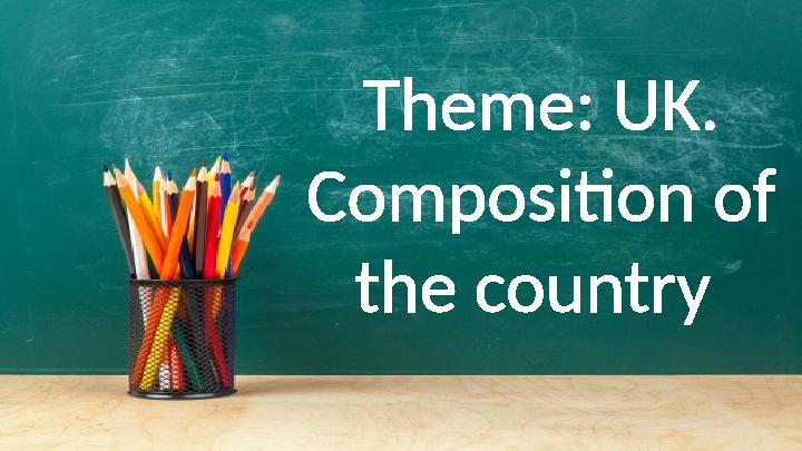
Theme: UK.
Composition of
the country
1 слайд
Theme: UK. Composition of the country

#2 слайд
Plan:
21 •
England
2 •
Scotland
3 •
Wales
4 •
Northern Ireland
2 слайд
Plan: 21 • England 2 • Scotland 3 • Wales 4 • Northern Ireland

#3 слайд
Englan
d1
3 слайд
Englan d1

#4 слайд
ENGLAND
Of the four parts which make up Great Britain
England is the largest, the industrial and most
densely populated part of the UK. It occupies an
area of 131,8 thousand sq. km. Over 46 million
people of the population of the UK live in
England.
The greatest concentrations of population are in
London, Birmingham and northwest industrial
cities. The coasts of England are washed by the
North Sea, the Irish Sea, the English Channel and
the Strait of Dover. No part of England is more
than 120 kilometers from the sea.
It is interesting to note that the sea has been
important in the history of England. It was a
good protection against the attacks of outside
peoples. Fishing has always been an important
industry, especially in the east. The sea also has a
great effect on England’s climate.
There are many rivers in England. The longest
and the most important is the Thames. The
rivers are of great importance for
communication and especially for carrying
goods.
England is mostly a lowland country. There are
upland regions in the north and the southwest,
but the rest of England is almost flat.
4 слайд
ENGLAND Of the four parts which make up Great Britain England is the largest, the industrial and most densely populated part of the UK. It occupies an area of 131,8 thousand sq. km. Over 46 million people of the population of the UK live in England. The greatest concentrations of population are in London, Birmingham and northwest industrial cities. The coasts of England are washed by the North Sea, the Irish Sea, the English Channel and the Strait of Dover. No part of England is more than 120 kilometers from the sea. It is interesting to note that the sea has been important in the history of England. It was a good protection against the attacks of outside peoples. Fishing has always been an important industry, especially in the east. The sea also has a great effect on England’s climate. There are many rivers in England. The longest and the most important is the Thames. The rivers are of great importance for communication and especially for carrying goods. England is mostly a lowland country. There are upland regions in the north and the southwest, but the rest of England is almost flat.
. The associati")
#5 слайд
The flag of England is derived from
Saint George's Cross
(heraldic
blazon :
Argent, a cross gules ). The
association of the red cross as an
emblem of England can be traced
back to the
Late Middle Ages , and it
was increasingly used alongside the
Royal Banner
in the wake of the
English Reformation , especially as a
maritime flag . It was used as a
component in the design of the
Union Jack
in 1606. The national flower of England is
the rose.
The flower has been
adopted as England’s emblem
since the time of the Wars of the
Roses - civil wars (1455-1485)The official Coat of Arms The
Three Lions Crest
Richard the
Lionheart
(1189 - 1199) used the
three golden lions (sometimes
described as leopards) on their
scarlet background as a powerful
symbol of the English Throne
during the time of the Crusades.The
flag of England Royal arms of England The national emblems of
England
5 слайд
The flag of England is derived from Saint George's Cross (heraldic blazon : Argent, a cross gules ). The association of the red cross as an emblem of England can be traced back to the Late Middle Ages , and it was increasingly used alongside the Royal Banner in the wake of the English Reformation , especially as a maritime flag . It was used as a component in the design of the Union Jack in 1606. The national flower of England is the rose. The flower has been adopted as England’s emblem since the time of the Wars of the Roses - civil wars (1455-1485)The official Coat of Arms The Three Lions Crest Richard the Lionheart (1189 - 1199) used the three golden lions (sometimes described as leopards) on their scarlet background as a powerful symbol of the English Throne during the time of the Crusades.The flag of England Royal arms of England The national emblems of England

#6 слайд
6Stonehenge Tower of
London Canterbury
Cathedral
The National
Gallery Warwick
Castle Tate Modern
6 слайд
6Stonehenge Tower of London Canterbury Cathedral The National Gallery Warwick Castle Tate Modern

#7 слайд
Scotlan
d2
7 слайд
Scotlan d2

#8 слайд
SCOTLAND
Scotland is the most northern of the countries
that constitute the UK. It occupies an area of 78.8
thousand sq. km. It means that Scotland takes up
one third of the territory of the British Isles, its
population is not very big. It is the most northern
part of the island of GB and is not far away from
the Arctic Circle. That’s why it is not densely
populated: its population is a little over 5 million
people. The Cheviot Hills mark the boundary
between England and Scotland. Apart from this
land link with England, Scotland is surrounded by
sea.
Status: Part of United Kingdom
First Minister: Jack McConnell (2001)
Land area: 30,414 sq mi (78,772 sq km)
Population (1996 est.): 5,128,000; density per sq
mi: 168.6
Capital (2003 est.): Edinburgh, 663,700 (metro.
area), 460,000 (city proper)
Largest city: Glasgow, 1,361,000 (metro. area),
1,099,400 (city proper)
Monetary unit: British pound sterling (£)
Languages: English, Scots Gaelic
Religions: Church of Scotland, Roman Catholic,
Scottish Episcopal Church, Baptist.
8 слайд
SCOTLAND Scotland is the most northern of the countries that constitute the UK. It occupies an area of 78.8 thousand sq. km. It means that Scotland takes up one third of the territory of the British Isles, its population is not very big. It is the most northern part of the island of GB and is not far away from the Arctic Circle. That’s why it is not densely populated: its population is a little over 5 million people. The Cheviot Hills mark the boundary between England and Scotland. Apart from this land link with England, Scotland is surrounded by sea. Status: Part of United Kingdom First Minister: Jack McConnell (2001) Land area: 30,414 sq mi (78,772 sq km) Population (1996 est.): 5,128,000; density per sq mi: 168.6 Capital (2003 est.): Edinburgh, 663,700 (metro. area), 460,000 (city proper) Largest city: Glasgow, 1,361,000 (metro. area), 1,099,400 (city proper) Monetary unit: British pound sterling (£) Languages: English, Scots Gaelic Religions: Church of Scotland, Roman Catholic, Scottish Episcopal Church, Baptist.

#9 слайд
The flag of Scotland (
Scottish Gaelic :
bratach na h-
Alba ;
Scots : Banner o Scotland ,
also known as
St Andrew's
Cross
or the Saltire ) [2]
consists
of a white
saltire defacing a
blue field. The Saltire, rather
than the
Royal Standard of Scotland , is
the correct flag for all private
individuals and corporate
bodies to fly. The
thistle , the national emblem
of ScotlandThe
royal arms of Scotland is the
official
coat of arms of the
King of Scots
first adopted in the
12th century. With the
Union of the Crowns
in 1603,
James VI
inherited the thrones of
England and Ireland and thus his
arms in Scotland were now
quartered with the arms of
EnglandThe
flag of Scotland Coat of arms of Scotland The national emblems of
Scotland
9 слайд
The flag of Scotland ( Scottish Gaelic : bratach na h- Alba ; Scots : Banner o Scotland , also known as St Andrew's Cross or the Saltire ) [2] consists of a white saltire defacing a blue field. The Saltire, rather than the Royal Standard of Scotland , is the correct flag for all private individuals and corporate bodies to fly. The thistle , the national emblem of ScotlandThe royal arms of Scotland is the official coat of arms of the King of Scots first adopted in the 12th century. With the Union of the Crowns in 1603, James VI inherited the thrones of England and Ireland and thus his arms in Scotland were now quartered with the arms of EnglandThe flag of Scotland Coat of arms of Scotland The national emblems of Scotland

#10 слайд
10Melrose
Abbey Skara Brae Stirling Castle
Loch Ness Edinburgh
Castle Ben Nevis
10 слайд
10Melrose Abbey Skara Brae Stirling Castle Loch Ness Edinburgh Castle Ben Nevis

#11 слайд
Wales3
11 слайд
Wales3
 Land area: 8,019 sq mi (20,768 sq km) Populat")
#12 слайд
WALES
Status: Part of United Kingdom
First Secretary: Rhodri Morgan (2000)
Land area: 8,019 sq mi (20,768 sq km)
Population (1993 est.): 2,906,500
Capital and largest city (2003 est.): Cardiff,
676,400 (metro. area), 280,800 (city proper)
Monetary unit: British pound sterling (£)
Languages: English, Welsh
Religions: Calvinistic Methodist, Church of Wales,
Roman Catholic
Wales is a peninsula washed by the sea on three
sides: the Bristol Channel in the south, the St.
George’s Channel in the west, and the Irish Sea
in the north. Its territory is 20,8 thousand sq.
km. Geographically Wales may be considered
part of highland Britain, the Cumbrian
Mountains occupying most of the land. It is an
area of high mountains, deep valleys, waterfalls
and lakes.
12 слайд
WALES Status: Part of United Kingdom First Secretary: Rhodri Morgan (2000) Land area: 8,019 sq mi (20,768 sq km) Population (1993 est.): 2,906,500 Capital and largest city (2003 est.): Cardiff, 676,400 (metro. area), 280,800 (city proper) Monetary unit: British pound sterling (£) Languages: English, Welsh Religions: Calvinistic Methodist, Church of Wales, Roman Catholic Wales is a peninsula washed by the sea on three sides: the Bristol Channel in the south, the St. George’s Channel in the west, and the Irish Sea in the north. Its territory is 20,8 thousand sq. km. Geographically Wales may be considered part of highland Britain, the Cumbrian Mountains occupying most of the land. It is an area of high mountains, deep valleys, waterfalls and lakes.
 consists of a red dragon")
#13 слайд
The Flag of Wales ( Welsh : Baner
Cymru
or Y Ddraig Goch , meaning '
the red dragon ') consists of a
red
dragon passant
on a green and
white field . As with many
heraldic charges , the exact
representation of the dragon is not
standardised and many renderings
exist. The flag is not represented in
the
Union Flag . The
daffodil is the
national flower
worn on
St David's Day
(1 March) in
Wales. The daffodil may be
known as
Welsh : cenhinen Bedr (
Saint Peter 's leek)The
Coat of Arms of the Principality of
Wales
which are the historic arms of
the
Kingdom of Gwynedd are
used by
Charles, Prince of Wales
in his personal standard. They are
also the basis for the
Royal Badge of Wales
issued in
2008 for the use of the
National Assembly for Wales .The
flag of Wales Coat of arms of Wales The national flower of Wales
13 слайд
The Flag of Wales ( Welsh : Baner Cymru or Y Ddraig Goch , meaning ' the red dragon ') consists of a red dragon passant on a green and white field . As with many heraldic charges , the exact representation of the dragon is not standardised and many renderings exist. The flag is not represented in the Union Flag . The daffodil is the national flower worn on St David's Day (1 March) in Wales. The daffodil may be known as Welsh : cenhinen Bedr ( Saint Peter 's leek)The Coat of Arms of the Principality of Wales which are the historic arms of the Kingdom of Gwynedd are used by Charles, Prince of Wales in his personal standard. They are also the basis for the Royal Badge of Wales issued in 2008 for the use of the National Assembly for Wales .The flag of Wales Coat of arms of Wales The national flower of Wales

#14 слайд
14Snowdonia
National Park Brecon Beacons
National Park Cardiff Castle
Devil's Bridge and
the Hafod Estate Wales by Rail Caernarfon
Castle
14 слайд
14Snowdonia National Park Brecon Beacons National Park Cardiff Castle Devil's Bridge and the Hafod Estate Wales by Rail Caernarfon Castle

#15 слайд
Norther
n
Ireland4
15 слайд
Norther n Ireland4
 (both official) Ethnicity/race: Celt")
#16 слайд
NORTHERN IRELAND
Status: Part of United Kingdom
Languages: English, Irish (Gaelic) (both official)
Ethnicity/race: Celtic, English
Religions: Roman Catholic 88%, Church of Ireland
3%, other Christian 2%, none 4%
Literacy rate: 98% (1981 est.)
Land area: 5,452 sq mi (14,121 sq km)
Population (1998 est.): 1,688,600
Capital and largest city (2003 est.): Belfast,
484,800 (metro. area), 246,200 (city proper)
Other large cities: Cork, 193,400; Limerick,
84,900; Galway, 67,200
Monetary unit: British pound sterling (£)
Northern Ireland occupies the north-eastern part
of Ireland, which is separated from the island of
Great Britain by the North Channel. In the south-
west Northern Ireland borders on the Irish
Republic.
Almost all the area of Northern Ireland is a plain
of volcanic origin, deepening in the centre to
from the largest lake of the British Isles, Lough
Neagh.
16 слайд
NORTHERN IRELAND Status: Part of United Kingdom Languages: English, Irish (Gaelic) (both official) Ethnicity/race: Celtic, English Religions: Roman Catholic 88%, Church of Ireland 3%, other Christian 2%, none 4% Literacy rate: 98% (1981 est.) Land area: 5,452 sq mi (14,121 sq km) Population (1998 est.): 1,688,600 Capital and largest city (2003 est.): Belfast, 484,800 (metro. area), 246,200 (city proper) Other large cities: Cork, 193,400; Limerick, 84,900; Galway, 67,200 Monetary unit: British pound sterling (£) Northern Ireland occupies the north-eastern part of Ireland, which is separated from the island of Great Britain by the North Channel. In the south- west Northern Ireland borders on the Irish Republic. Almost all the area of Northern Ireland is a plain of volcanic origin, deepening in the centre to from the largest lake of the British Isles, Lough Neagh.

#17 слайд
The only official flag in Northern
Ireland
is the Union Flag of the
United Kingdom .
The
Ulster Banner was
used by the
Northern Ireland government
from
1953 until the government and
parliament
were abolished in 1973.
Since then, it has had no official
status.
However, it is still used as the
flag of Northern Ireland by
loyalists and
unionists , [10][11]
and to represent
Northern Ireland internationally in
some sporting competitions. The names derives from the Irish
word seamróg which means
“Little Clover”. There is in fact no
single species of flower called
Shamrock. A Shamrock is
basically any examples of Lesser
Clover, White Clover,Red Clover,
Black Medick and Wood Sorrel
which have 3 more or less heart
shaped leaves.The
coat of arms of the Government
of
Northern Ireland was granted to the
Executive Committee of the Privy Counc
il of Northern Ireland
in 1924.
The coat of arms was designed by
Major Sir Nevile Wilkinson ,
Ulster King of Arms , at
Dublin Castle , in
1923. In January 1924, Major Wilkinson
held discussions with Northern Irish
officials in
London regarding the coat of
arms.The
flag of Coat of arms of Northern
Ireland The national flower of
17 слайд
The only official flag in Northern Ireland is the Union Flag of the United Kingdom . The Ulster Banner was used by the Northern Ireland government from 1953 until the government and parliament were abolished in 1973. Since then, it has had no official status. However, it is still used as the flag of Northern Ireland by loyalists and unionists , [10][11] and to represent Northern Ireland internationally in some sporting competitions. The names derives from the Irish word seamróg which means “Little Clover”. There is in fact no single species of flower called Shamrock. A Shamrock is basically any examples of Lesser Clover, White Clover,Red Clover, Black Medick and Wood Sorrel which have 3 more or less heart shaped leaves.The coat of arms of the Government of Northern Ireland was granted to the Executive Committee of the Privy Counc il of Northern Ireland in 1924. The coat of arms was designed by Major Sir Nevile Wilkinson , Ulster King of Arms , at Dublin Castle , in 1923. In January 1924, Major Wilkinson held discussions with Northern Irish officials in London regarding the coat of arms.The flag of Coat of arms of Northern Ireland The national flower of

#18 слайд
18The Giant's
Causeway The Causeway
Coast and Dunluce
Castle Carrick-a-Rede
Rope Bridge
Carrickfergus
Castle Ards
Peninsula Lough Erne
18 слайд
18The Giant's Causeway The Causeway Coast and Dunluce Castle Carrick-a-Rede Rope Bridge Carrickfergus Castle Ards Peninsula Lough Erne


 Жүктеу
шағым қалдыра аласыз


 Бұл курс Қазақстан Республикасы Оқу-ағарту министрлігімен келісілген


