Конспект внеклассного мероприятия по английскому языку на тему:
«A TOUR OF GREAT BRITAIN - Тур по Великобритании»
Класс: 8 Е
Цели:
Образовательные: в занимательной форме выявить уровень знаний учащихся по теме «Великобритания» (основные географические данные- население, столицы, символы, культурные достопримечательности некоторых городов, флаги и др.), систематизировать знания по данной теме.
Развивающие: развивать память, речь, внимание, смекалку, умение работать в команде,
добиваться поставленных целей.
Воспитательные: воспитывать культуру поведения, уважение и интерес к культурному наследию страны изучаемого языка.
Оборудование: презентация с вопросами викторины, для каждой команды- флаг и карта Великобритании (черно-белый вариант), карточки с цифрами 1-4 для каждой команды.
Задачи:
Образовательная: приобретение знаний о стране изучаемого языка
Воспитательная: воспитание положительного отношения к культуре народа изучаемого языка.
Развивающая: развитие творческих способностей учащихся.
Ход мероприятия
-Hello, my dear boys and girls! We are glad to greet you at our competition! All children like to compete. That's why we'll play the game " A TOUR OF GREAT BRITAIN " today. There are 4 teams in our classroom and we have three members of our jury today.
The first one is called «....» , and its captain is ......
The 2nd team is called «......» , and its captain is .......
The 3rd team is called «......» , and its captain is .......
The 4th team is called «......» , and its captain is .......
The members of our jury are: ……….
Приветствие учителя и представление судей. Сейчас посмотрите, пожалуйста, на доску
Today we will talk about:
- Geographical position of England
- About known people and a lot of tasks
Задание1. Посмотрите на карту Великобритании и ответьте на вопросы
Каждой команде раздаются вопросы, отвечают письменно(3 мин)
-
How many parts are there in the United Kingdom? 4
2. What river is the capital situated on ? Themes
3. Which seas and channels separate the British isles ? (The Irish Sea).
1. Say the names of the four main parts of the UK and their capitals
2. Where is the United Kingdom situated?(It is situated on the islands in the northwest of Europe.)
3. Which island is the largest one?(Great Britain is the largest island.)
1. What separates Great Britain from the Continent?(The English Channel separates Great Britain from the Continent.)
2. How many countries does the UK consist of?(The UK consists of 4 countries: England, Scotland, Wales and Northern Ireland.)
3. What is the population of the UK?(The population of the UK is about 60 million people.)
1. Which city is the capital of the country?(London is the capital of the country.)
2. Say the names of the four main parts of the UK and their capitals.
3. How many countries does the UK consist
of?
Задание 2. Посмотрите на фотографии и скажите, кого из этих людей вы знаете
What people on these pictures do you know? (1 мин)


(отвечает команда кто 1 поднимет руку)
Задание 3. Поставьте буквы в правильном порядке так, чтобы у вас получились названия стран. (Put these letters in a correct order so to receive names of the countries. Name these countries).(5-7)
1.iecmaar America
2.zrlbia Brazil
3.danaac Canada
4.gdelenn England
5.rmyange Germany
6.lytaI Italy
7.atcsdlon Scotland
8.alswe Wales
Задание 4. Найдите части Великобритании для этих флагов. (Find parts of the Great Britain for these flags)(5 мин)

![]()
![]()
![]()
![]()
Задание 5. Вспомните достопримечательности, найдите фото и расскажите о них. (3 мин)
Trafalgar Square
The Houses of Parliament
Big Ben
Stonehenge
Задание 6. Найдите русский вариант к этим пословицам (3 мин)
|
1. Money has no smell. 2. God helps those who help themselves. 3. Better late than never. 4. Never too old to learn. 5. Not all that glitters is gold. 6. The early bird catches the worm. |
- Не все то золото, что блестит. - На бога надейся, а сам не плошай. - Деньги не пахнут. - Кто рано встает тому бог подает. - Учится никогда не поздно. - Лучше поздно, чем никогда. |
Задание 7. Путешествие по карте Великобритании (3мин)
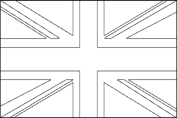
Двум командам выдается лист с напечатанными флагом и картой Великобритании. За отведенное время (10 минут) команды должны:
- раскрасить государственный флаг Великобритании
- оформить карту страны с указанием основной географической информации (название страны, столицы, символы, население, города, достопримечательности и др.)
Задание 8. знаки препинания- Punctuation marks
The geographical position.
The Great Britain or England as they often call the United Kingdom of Great Britain and Northern Ireland is situated on the British Isles in the European continent of the world. They include two big islands - the largest is Great Britain and the other – Ireland and more than 5 thousand small islands around them.
The territory of Great Britain occupies the island Great Britain and the northern part of the island Ireland. The country consists of four parts: England, Scotland, Wales and Northern Ireland.
There are no high mountains and very long rivers in the U.K. The highest mountain is in the north, in Scotland, its name is Ben Nevis. Its height is a little more than 1 thousand meters high. The longest river is the Severn, 350 meters long. The U.K. is washed by the Atlantic Ocean in the west, by the Northern Sea in the east and between them there is the Irish Sea.
The population.
Nearly 60 million people live in the U.K. The most populated part of the Great Britain is its central part - England, where 46 million people live, the densely populated, only 5 million live there – Scotland, which is situated in the north of the country. In Wales, the western part of the Great Britain only 3 million people live. All people in the Great Britain use English language as their state one and of course they can speak their native languages: in Scotland – Scottish, in Wales – Welsh, in Northern Ireland – Irish.
Who rules Britain?
Задание . Экскурсия по Лондону (достопримечательности, интересные факты, любимые места).
В конце судьи подсчитывают баллы. Выдают грамоты командам и активным участникам
жүктеу мүмкіндігіне ие боласыз
Бұл материал сайт қолданушысы жариялаған. Материалдың ішінде жазылған барлық ақпаратқа жауапкершілікті жариялаған қолданушы жауап береді. Ұстаз тілегі тек ақпаратты таратуға қолдау көрсетеді. Егер материал сіздің авторлық құқығыңызды бұзған болса немесе басқа да себептермен сайттан өшіру керек деп ойласаңыз осында жазыңыз
«A TOUR OF GREAT BRITAIN - Тур по Великобритании»
«A TOUR OF GREAT BRITAIN - Тур по Великобритании»
Конспект внеклассного мероприятия по английскому языку на тему:
«A TOUR OF GREAT BRITAIN - Тур по Великобритании»
Класс: 8 Е
Цели:
Образовательные: в занимательной форме выявить уровень знаний учащихся по теме «Великобритания» (основные географические данные- население, столицы, символы, культурные достопримечательности некоторых городов, флаги и др.), систематизировать знания по данной теме.
Развивающие: развивать память, речь, внимание, смекалку, умение работать в команде,
добиваться поставленных целей.
Воспитательные: воспитывать культуру поведения, уважение и интерес к культурному наследию страны изучаемого языка.
Оборудование: презентация с вопросами викторины, для каждой команды- флаг и карта Великобритании (черно-белый вариант), карточки с цифрами 1-4 для каждой команды.
Задачи:
Образовательная: приобретение знаний о стране изучаемого языка
Воспитательная: воспитание положительного отношения к культуре народа изучаемого языка.
Развивающая: развитие творческих способностей учащихся.
Ход мероприятия
-Hello, my dear boys and girls! We are glad to greet you at our competition! All children like to compete. That's why we'll play the game " A TOUR OF GREAT BRITAIN " today. There are 4 teams in our classroom and we have three members of our jury today.
The first one is called «....» , and its captain is ......
The 2nd team is called «......» , and its captain is .......
The 3rd team is called «......» , and its captain is .......
The 4th team is called «......» , and its captain is .......
The members of our jury are: ……….
Приветствие учителя и представление судей. Сейчас посмотрите, пожалуйста, на доску
Today we will talk about:
- Geographical position of England
- About known people and a lot of tasks
Задание1. Посмотрите на карту Великобритании и ответьте на вопросы
Каждой команде раздаются вопросы, отвечают письменно(3 мин)
-
How many parts are there in the United Kingdom? 4
2. What river is the capital situated on ? Themes
3. Which seas and channels separate the British isles ? (The Irish Sea).
1. Say the names of the four main parts of the UK and their capitals
2. Where is the United Kingdom situated?(It is situated on the islands in the northwest of Europe.)
3. Which island is the largest one?(Great Britain is the largest island.)
1. What separates Great Britain from the Continent?(The English Channel separates Great Britain from the Continent.)
2. How many countries does the UK consist of?(The UK consists of 4 countries: England, Scotland, Wales and Northern Ireland.)
3. What is the population of the UK?(The population of the UK is about 60 million people.)
1. Which city is the capital of the country?(London is the capital of the country.)
2. Say the names of the four main parts of the UK and their capitals.
3. How many countries does the UK consist
of?
Задание 2. Посмотрите на фотографии и скажите, кого из этих людей вы знаете
What people on these pictures do you know? (1 мин)


(отвечает команда кто 1 поднимет руку)
Задание 3. Поставьте буквы в правильном порядке так, чтобы у вас получились названия стран. (Put these letters in a correct order so to receive names of the countries. Name these countries).(5-7)
1.iecmaar America
2.zrlbia Brazil
3.danaac Canada
4.gdelenn England
5.rmyange Germany
6.lytaI Italy
7.atcsdlon Scotland
8.alswe Wales
Задание 4. Найдите части Великобритании для этих флагов. (Find parts of the Great Britain for these flags)(5 мин)

![]()
![]()
![]()
![]()
Задание 5. Вспомните достопримечательности, найдите фото и расскажите о них. (3 мин)
Trafalgar Square
The Houses of Parliament
Big Ben
Stonehenge
Задание 6. Найдите русский вариант к этим пословицам (3 мин)
|
1. Money has no smell. 2. God helps those who help themselves. 3. Better late than never. 4. Never too old to learn. 5. Not all that glitters is gold. 6. The early bird catches the worm. |
- Не все то золото, что блестит. - На бога надейся, а сам не плошай. - Деньги не пахнут. - Кто рано встает тому бог подает. - Учится никогда не поздно. - Лучше поздно, чем никогда. |
Задание 7. Путешествие по карте Великобритании (3мин)
Двум командам выдается лист с напечатанными флагом и картой Великобритании. За отведенное время (10 минут) команды должны:
- раскрасить государственный флаг Великобритании
- оформить карту страны с указанием основной географической информации (название страны, столицы, символы, население, города, достопримечательности и др.)

Задание 8. знаки препинания- Punctuation marks
The geographical position.
The Great Britain or England as they often call the United Kingdom of Great Britain and Northern Ireland is situated on the British Isles in the European continent of the world. They include two big islands - the largest is Great Britain and the other – Ireland and more than 5 thousand small islands around them.
The territory of Great Britain occupies the island Great Britain and the northern part of the island Ireland. The country consists of four parts: England, Scotland, Wales and Northern Ireland.
There are no high mountains and very long rivers in the U.K. The highest mountain is in the north, in Scotland, its name is Ben Nevis. Its height is a little more than 1 thousand meters high. The longest river is the Severn, 350 meters long. The U.K. is washed by the Atlantic Ocean in the west, by the Northern Sea in the east and between them there is the Irish Sea.
The population.
Nearly 60 million people live in the U.K. The most populated part of the Great Britain is its central part - England, where 46 million people live, the densely populated, only 5 million live there – Scotland, which is situated in the north of the country. In Wales, the western part of the Great Britain only 3 million people live. All people in the Great Britain use English language as their state one and of course they can speak their native languages: in Scotland – Scottish, in Wales – Welsh, in Northern Ireland – Irish.
Who rules Britain?
Задание . Экскурсия по Лондону (достопримечательности, интересные факты, любимые места).
В конце судьи подсчитывают баллы. Выдают грамоты командам и активным участникам

шағым қалдыра аласыз


